

Impacts on level crossings
You can find out more here about which crossings maybe affected, why the closures could be needed, the potential impacts from the closures and new access arrangements.
Level Crossings – possible need for closures
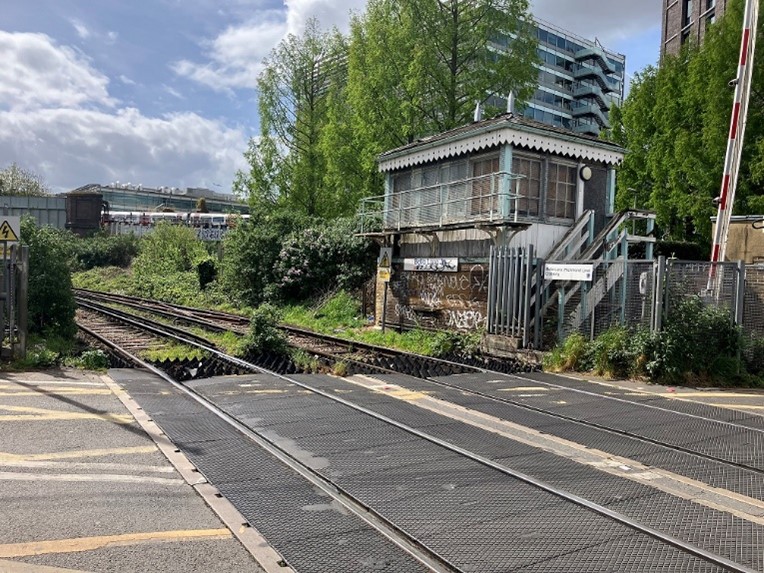 We may need to close three level crossings if the WLO were to go ahead:
- Churchfield Road next to Acton Central station
- Bollo Lane (Mildmay line) in South Acton
- Wood Lane in Isleworth
If the crossings need to close, we would ensure pedestrians and cyclists can still cross the railway at the same location or as nearby as possible, and that any closures are mitigated by enhancements to active travel and the street environment.
Should changes be required, this would provide an opportunity to reimagine these locations as safer, greener and better-connected places. Our aim would be not only to maintain convenient crossings for pedestrians and cyclists, but also to enhance the local environment through improved walking and cycling routes, public realm upgrades, new planting and measures that support thriving neighbourhoods and local businesses.
This consultation presents an overview of the range of options that may be considered for these three locations as the WLO is developed. There will be additional opportunities for feedback as the project progresses through future public consultation and engagement.
Why closures could be needed
Running more passenger trains through these crossings would increase how often barriers need to be lowered and the amount of time they would be closed for. This would have implications for safety, traffic flows, and how local streets operate. For this reason, the future of the level crossings needs to be considered alongside the development of the WLO.
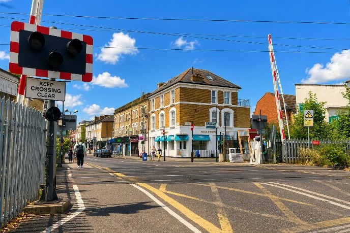 Under current railway operating rules, the level crossing barriers - which are already lowered for around 40% to 50% of the time during the day - would be closed for longer periods and the safety risks of continuing to operate the crossings would increase. For example, there could be an increase in risk taking behaviour from drivers and pedestrians frustrated by a long wait to cross the railway. When WLO services are added, the barriers would be lowered for up to 75% of the time for periods as long as 11 minutes at a time. While technology improvements are being explored which could result in barrier down times not increasing this much, based on the current rules closure of the level crossings to road traffic would be required.
Regardless of the WLO, closing level crossings where reasonably practicable to separate the public from the railway is a national Network Rail policy for safety reasons and a programme of level crossing closures is ongoing nationwide.
We are looking at where displaced traffic might go and how we would minimise the impact on local residents, businesses, pedestrians and cyclists if the level crossings have to close. We are also assessing whether there are safe and practical ways for any of the crossings to remain open. For example, reducing vehicular traffic using the crossings to local residents only, while also providing alternative ways for pedestrians to cross the railway, could offset the increased safety risks resulting from longer barrier down times.
Potential impacts of level crossing closures
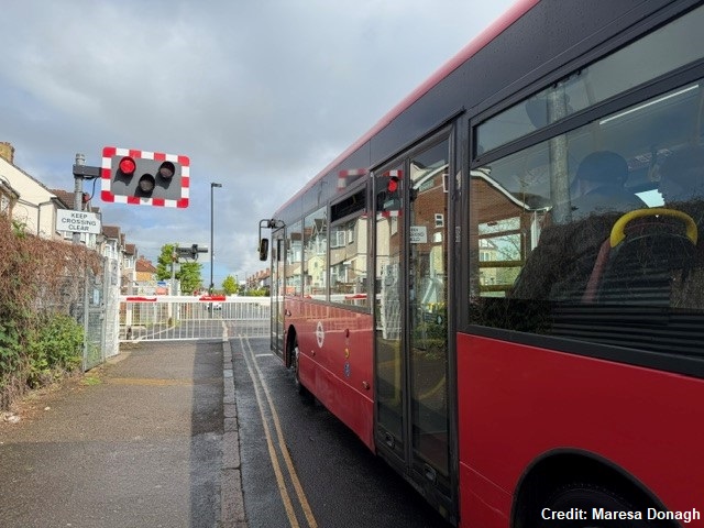 If the level crossings have to close, this would mean that people travelling on foot, by cycle or in a vehicle would need to find alternative ways to cross the railway line. For vehicles, this would involve having to cross the railway at an alternative location, while bridges or other options for pedestrians and cyclists to cross the railway would be available at the crossing closure points or nearby.
When a level crossing is closed, traffic levels would reduce in the immediate area but may increase on some surrounding roads. Where traffic reduces, there will be opportunities to repurpose street space to improve the local environment and prioritise people with, for example, wider pavements, cycling improvements, pedestrianisation, and planting. Where traffic increases, measures could be introduced to control vehicle speeds or restrict vehicle access.
New access arrangements
The level crossings all have residential properties and other facilities such as shops and schools nearby. If a decision were taken that the level crossings would need to close, care will be taken to ensure pedestrians and cyclists can still safely cross the railway.
We would make sure that:
- Accessible, convenient and attractive routes are still available for pedestrians and cyclists to cross the railway safely
- Displaced traffic can continue to move around the area without causing problems. We need to do further work to fully understand traffic impacts and this will involve ongoing engagement with local communities and further formal consultation in the future
The alternative pedestrian and cyclist crossing solutions we are exploring include:
- Footbridges at all three crossings which could allow many users to cross without a long detour. These structures would need to be high enough to clear the railway and include either lifts or ramps to be accessible for all
- The subway that already exists at Acton Central that could also offer step-free access
To help inform our work we have:
- Surveyed the number of users at each crossing - including people, cyclists and vehicles using each crossing
- Started carrying out traffic modelling to determine the likely effects of any displaced traffic on nearby roads
- Started discussions with the boroughs who manage these local road networks to look at the impact of level crossing closures on other local roads
- Begun considering what improvements to the street environment could be introduced around any closure points for the benefit of the local areas
We would like to hear from local people, businesses and other stakeholders about any concerns and insights which will help us develop our proposals. We also plan to start a programme of engagement with the local communities and business groups around the level crossings, informed by the results of this consultation, to help us identify the best solutions. We will consult on detailed proposals for any level crossing closures in a future WLO public consultation.
Churchfield Road, Acton
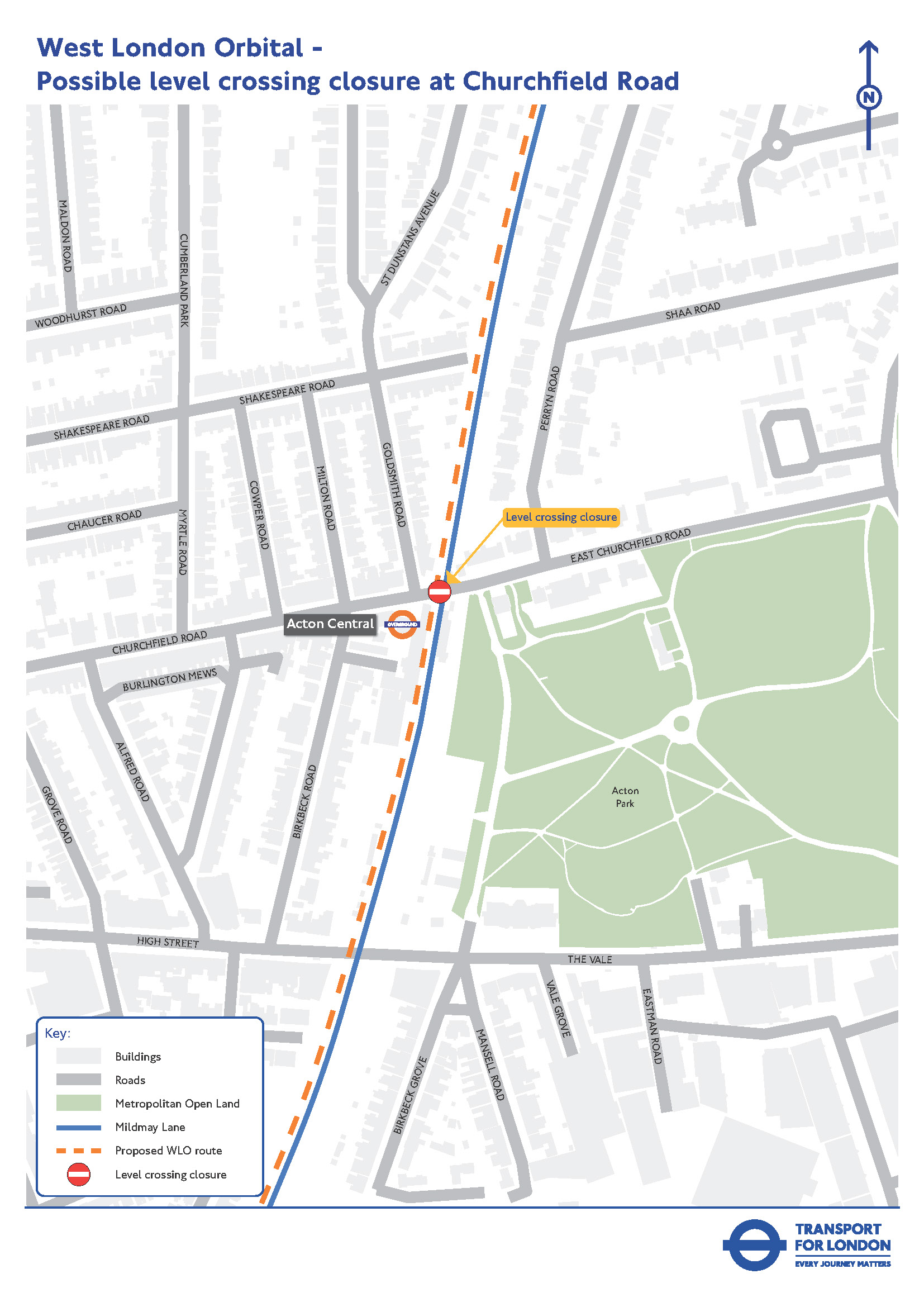 (Click map for larger version)
The area around Churchfield Road is surrounded by residential properties and local businesses. It is situated within a conservation area, with the high street to the west and Acton Park to the east. The level crossing is adjacent to Acton Central station which is served by the Mildmay line.
Closing the level crossing would have the potential to improve the local environment. We will be looking at options that could be considered to improve the street environment either side of the crossing.
We are looking at options to maintain pedestrian and cyclist access across the railway if the crossing has to close.
The solution could involve a new pedestrian/cycle bridge or make use of the existing station subway. We are considering several factors to help determine the most appropriate solution.
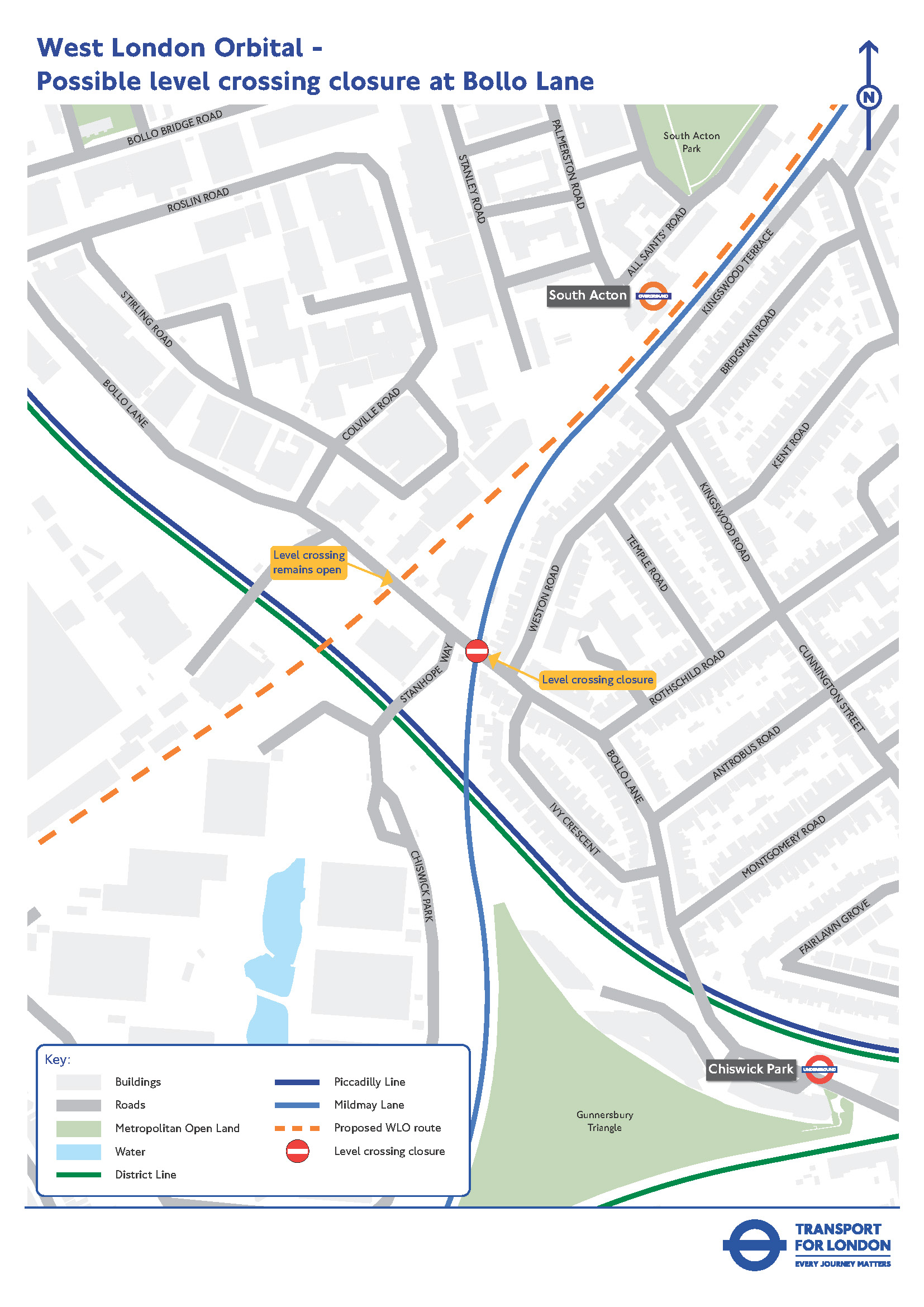
Bollo Lane, South Acton
 (Click map for larger version)
The area around Bollo Lane includes a mix of commercial and residential uses, with several developments planned to come forward in the coming years.
Bollo Lane has two level crossings in close proximity to each other. These are:
- The ‘Kew line’ to the north, which would be used by WLO services, and is currently used only for freight trains
- The ‘Richmond line’ to the south, which is currently used by both Mildmay line and freight services
Due to the proximity of the crossings, if they were to remain open to traffic when WLO services begin to run, the barriers on both crossings would need to come down for a train passing on either line, to avoid the risk of vehicles queuing over the other crossing.
Under current railway operating rules, at least one level crossing would therefore likely need to close, and through traffic would be displaced onto other routes.
It would be more practical to close the Richmond line level crossing on the Mildmay line, rather than the Kew Line (potential WLO) crossing because:
- It would ensure access remains available to Chiswick Business Park and other properties between the two crossings, including for bus routes 440 and 70, so these bus routes would not need to be changed
- The Kew line barriers for WLO trains would be able to remain open for traffic for around 60 per cent of the time since few other trains would be using this crossing. This is acceptable from a safety perspective considering that through traffic would no longer be using Bollo Lane
- Closing the Richmond line crossing would also reduce the amount of traffic on Bollo Lane needing to queue while barriers are down at the Kew line crossing
- Reducing through traffic on Bollo Lane would also support the redevelopment plans for the area which are to prioritise pedestrians where possible
If this crossing has to close, the most likely option to maintain pedestrian and cycling access at this location could involve a new pedestrian/cycle bridge. We are also considering whether alternative pedestrian and cycle arrangements could be provided at nearby locations. This will be explored as part of the next design stage.
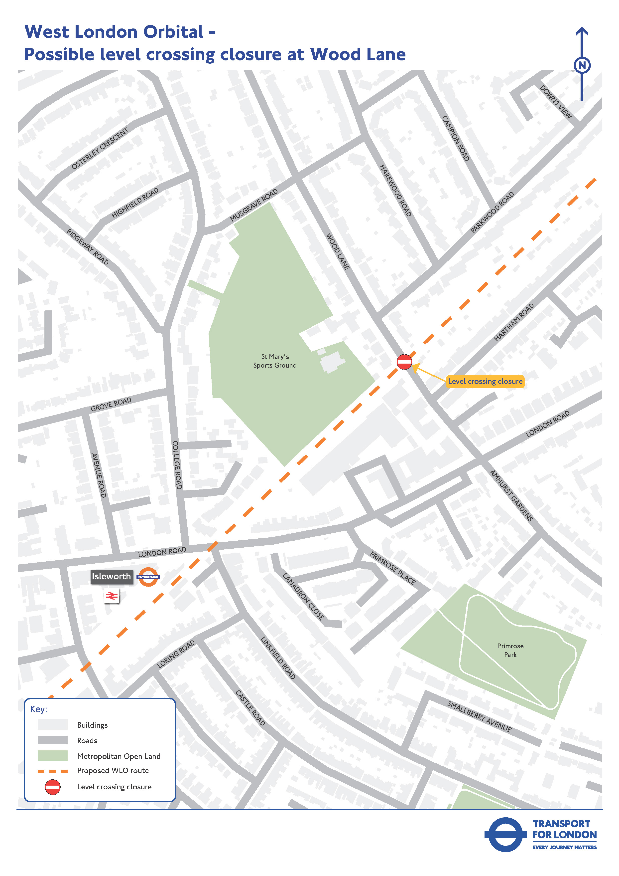
Wood Lane, Isleworth
 (Click map for larger version)
The level crossing on Wood Lane, Isleworth, could also need to close. It is located in a mainly residential area, with some commercial properties, the Old Isleworthians Sports club and the Woodbridge Park Education Service Aspire Centre nearby.
If the crossing has to close, we will look at any feasible options to maintain pedestrian and cycling access. We are considering several factors to help determine the most appropriate solution.
We would also need to consult on changes to the H28 bus route, which currently uses this level crossing, if the crossing has to close. Any proposals for the H28 route would need to be consulted on in detail before changes could be made.
Next steps
We need to do more work on these proposals as part of the overall development of the WLO project. Construction of the WLO project would not start until the early 2030s, so there would be no impact on the level crossings in the next few years.
These changes would have impacts, both positive and negative, for local residents and businesses and we would like to hear feedback to help inform this work. Please complete our survey.


