
FAQs
What is Vision Zero for London?
Vision Zero represents our aim to eradicate deaths and serious injuries from our roads and make London a safer, healthier and greener place by 2041.
Major cities around the world are taking a stand to end the toll of deaths and injury seen on their roads and transport networks by committing to Vision Zero. London is at the forefront of this approach and the Mayor's Transport Strategy sets out the goal that, by 2041, all deaths and serious injuries will be eliminated from London's transport network.
It is neither inevitable nor acceptable that anyone should be killed or seriously injured when travelling in London. When we leave our homes each day, we should feel safe and confident about the journey ahead.
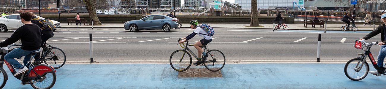
The proposals at Battersea Bridge’s northern junction are part of the work we are doing towards meeting the Vision Zero aim.
What impact will the scheme have on traffic/journey times?
We are doing detailed traffic modelling to help us predict the potential impact on traffic using the junction and in the vicinity of the junction.
Journey times through the junction, which is already congested at times, will increase because of the changes proposed - but this is a necessary compromise to deliver important safety improvements for vulnerable road users.
We have thought carefully about our proposals to ensure that their impact on journey times is limited. We have achieved this by reducing the number of traffic movements at the junction, and phasing the pedestrian crossings to run when traffic is running in other areas.
We are proposing a new westbound bus lane - between Royal Hospital Road and the bus stop ‘Beaufort Street’ (BC) - to further protect bus journey times.
Later this year we will consult on proposed changes on the south side of Battersea Bridge, which should also help to protect the journey times of northbound bus routes.
Why are you proposing to ban the left turn into Beaufort Street?
We have proposed to ban this turn to reduce the number of movements at the junction, and to protect bus and traffic journey times over the wider area. This proposal is based on the fact that a relatively small number of vehicles make this turning movement into Beaufort Street, compared to high volumes of vehicles travelling west to east who would otherwise have much longer journey times if the turn was not banned (with the potential to create traffic queues to King’s Road).
Banning the left turn also eliminates the risk of any left turning vehicles colliding with pedestrians as they cross Beaufort Street - and helps make pedestrians more visible to drivers, by widening the pavement at the north-west corner of the junction. It also allows us to locate the crossing closer to the junction, where pedestrians want to cross.
Won’t banning the left turn in Beaufort Street just make traffic congestion worse at this junction and force more traffic onto other residential roads in the area?
According to the latest traffic data, a very low number of vehicles currently turn left into Beaufort Street from Cheyne Walk*. Any increase in traffic using other north-south roads through the area is therefore negligible.
Currently, there is a dedicated lane on the eastbound approach to the junction for vehicles turning left into Beaufort Street. This is an inefficient use of road space, which contributes to congestion at the southern end of Beaufort Street. In our proposals there would only be straight-ahead eastbound traffic, which would make the junction operate more efficiently. We intend to allocate the space freed up by the removal of the left-turn lane to cyclists and pedestrians, and give them more ‘green man’ time - making both walking and cycling safer and more pleasant.
In developing our plans for the junction, we looked into several options which would retain the left turn into Beaufort Street. These options were all subjected to high-level traffic modelling**. The results of this showed that keeping the left turn into Beaufort Street would cause severe congestion for all traffic at the junction, create queues on Cheyne Walk towards the King’s Road, and have an unacceptable negative impact on buses. It is vital, as we continue to recover from the pandemic, that we make buses run as efficiently as possible, as it is a highly accessible and affordable form of transport relied upon by many residents.
*In the morning peak: around 48 vehicles per hour. In the evening peak: around 51 vehicles per hour.
**Traffic modelling is a computer simulation of real-world traffic conditions. This high-level process uses mathematical calculations to give us an indication of how well or poorly roads would operate if we were to make changes such as those being proposed at Battersea Bridge’s northern junction. A more detailed traffic modelling process is currently underway.
What are the plans for extending the existing walking and cycling scheme (which currently ends at Chelsea Bridge/Chelsea Bridge Road?
High numbers of people are already choosing to cycle beyond the end of the existing scheme along Chelsea Embankment/Cheyne Walk*. While this section of the road network is popular with cyclists, it also has a poor record of collisions. We are therefore extremely keen to extend the existing experimental scheme farther west along Chelsea Embankment/Cheyne Walk to help improve safety for cyclists. Once we reach an agreement with the Government over our long-term funding, we plan to do more design work on the scheme. Any plans would be subject to a public consultation.
*The existing experimental scheme is currently being consulted on at https://haveyoursay.tfl.gov.uk/lambeth-chelsea-bridge. The consultation runs until 9 November 2022.
