
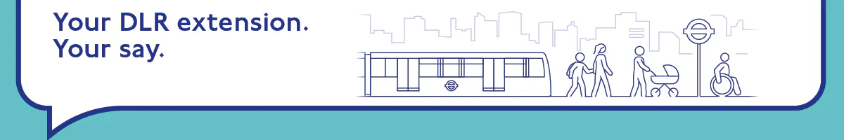
Extending the DLR to Beckton Riverside and Thamesmead
We would like your feedback on our continued work to develop proposals for the DLR extension to Beckton Riverside and Thamesmead. This includes how the two new stations could look and would be accessed by our customers, information on how the extension could be built, and the impacts of construction on local communities, businesses and the environment.
The consultation period has now closed. You can find updates on the scheme in the 'Latest news' section.
Background and design so far
In this section we provide information about:
- The route and new stations
- Why we want to build the DLR extension
- Funding the extension
- What's happened so far
- What happens next
- Other transport projects in the area
The route and new stations
Together with our partners the Royal Borough of Greenwich and London Borough of Newham, and landowners and developers Peabody, Lendlease, Aberdeen Investments and Berkeley, we have continued work on the proposed route and new stations for the extension.
The proposed extension would branch off from the existing DLR line after Gallions Reach, travelling through the Beckton Riverside area on a viaduct before descending to a new ground-level station in Beckton Riverside to the south of Armada Way. From here the track would descend underground into a tunnel to cross under the River Thames to continue the journey towards Thamesmead.
The track would come out of the tunnel at Thamesmead onto a viaduct to pass over the Twin Tumps and Thamesmere before terminating at an elevated station in Thamesmead town centre on the current site of Cannon Retail Park.
 (Click on map for a larger version)
We have continued to work on the designs for the two new stations at Beckton Riverside and Thamesmead. In the previous consultation, we gave you information about where the new stations would be and what they could look like. Since that consultation, we have continued to work on the designs of the new stations, especially how they would integrate and be accessed from the surrounding areas.
View more information about the route and new stations
Why we want to build the DLR extension
Beckton Riverside and Thamesmead both lack direct rail services. This lack of direct public transport has limited local access to jobs, education, and services for decades.
The extension would:
- Give these areas fast and reliable public transport services
- Help support the building of up to 30,000 new homes and the creation of up to 10,000 jobs in Beckton Riverside and Thamesmead Waterfront
- Cut journey times; travelling to the City would drop from about an hour to 35–40 minutes, with trains initially every 8–10 minutes
- Strengthen east London’s cross‑river links, which are currently limited
- Support modal shift from private car to a more sustainable transport mode

Funding the extension
As part of the Autumn Budget in November 2025, the Government announced their commitment to the scheme, including financial support to help us deliver it. This includes a mechanism that enables the Mayor to raise funds through borrowing to pay for the scheme’s construction. This borrowing will be repaid over time using direct funding from Government and new funding unlocked by the scheme, such as the fares revenue from ridership on the extended portion of the DLR route. This funding model builds on the approach successfully delivered on previous projects such as Crossrail and the Northern line extension.
We are working closely with officials from across government departments to finalise formal arrangements for the funding package.
What’s happened so far
Work on a potential DLR extension began in 2019, with public consultation starting in 2024. Support has remained consistently strong and has played a major role in shaping the work we are consulting on now.
Before our first consultation in February 2024, we assessed whether a DLR extension was the right solution for improving links to two major growth areas. Feedback showed clear backing for the concept, especially the need for better cross‑river connections and support for new homes. This confirmed the preferred route and firmly established Beckton Riverside and Thamesmead as the key areas to serve. In addition to the consultation, we ran sample polling in locations in Beckton, Gallions Reach, Thamesmead and Abbey Wood. Of the 356 people we polled, 85% supported or strongly supported our proposals.
View the 2024 consultation report
As the design developed, we carried out a second consultation in June 2025 where we asked for views on station options, tunnel plans and construction impacts. More than 1,400 people responded, with strong support for the core elements:
- 76% backed the route from Gallions Reach
- 66% supported our proposed location for a station at Beckton Riverside
- 77% supported our proposed location for a station in Thamesmead town centre
We also gave more information about the case for the scheme and our options selection process for deciding where the new stations should be located.
This feedback directly shaped the proposals now being taken forward.
View the 2025 consultation report
What happens next
We will continue to develop our proposals and complete the Environmental Impact Assessment work. This will help us to confirm the design of the final scheme that we will apply for permission to build and operate through a Transport and Works Act Order (TWAO) application.
We are planning to submit this application in early 2027.
View more detailed information about the TWAO process
Subject to a funding agreement with Government and the necessary permissions granted, construction could begin by 2029 with the extension and new stations at Beckton Riverside and Thamesmead potentially opening in the early 2030s.
Other transport projects in the area
Transport improvements in Thamesmead
Alongside the proposed DLR extension, we are continuing to develop plans for other changes in Thamesmead following recent public consultations. These are changes to roads between Woolwich and Abbey Wood via Thamesmead, aimed at making bus journeys faster and to improve the area for people walking and cycling. Also, the creation of a new road for buses, cyclists and pedestrians, which would join up the two ends of Barnham Drive.
View the Thamesmead bus lane, walking and cycling consultation report
View the Barnham Drive consultation report
Thames Gateway Bridge
In the previous consultation, we told you about the interface between land needed to deliver new homes and town centres in Beckton Riverside and Thamesmead and land safeguarded for the previously proposed Thames Gateway Bridge project. The safeguarding direction for the bridge was removed in July 2025 and there are no plans to build this road bridge.
How we could build it
In this section we provide information about how we could build the the DLR extension, including details about:
- Construction worksites in Beckton Riverside, under the River Thames and in Thamesmead town centre
- Managing construction across all areas
- Code of Construction access
Building the DLR extension would involve up to five years of construction activity in Beckton Riverside, Thamesmead, and beneath the River Thames. We want to deliver this new transport link as safely and efficiently as possible, while keeping disruption to local communities, businesses, and road users as low as possible.
To build the extension, work would take place in three areas:
- Beckton Riverside – we would construct a new junction with the existing DLR, build new viaducts, create the Beckton Riverside station, and launch the tunnel boring machine
- Under the River Thames – we would excavate two 1.5 kilometre tunnels, one in each direction, to provide the river-crossing for the new railway
- Thamesmead town centre – we would build a shaft where the tunnel boring machine will arrive, create new viaduct structures, and deliver the new Thamesmead station
The works would be delivered in the following phases:
- Preparing sites – clearing land, setting up compounds, and diverting utilities
- Building foundations and structures – creating piles, viaduct supports, station bases, and tunnel shafts
- Tunnelling and major construction – excavating the tunnel beneath the River Thames and building both new stations
- Railway systems installation – laying track, installing power, signalling and telecoms, and integrating the line with the existing DLR north of Gallions Reach station
- Finishing works – landscaping, public realm improvements, and integrating the extension into the surrounding area
Construction worksites
We would need several worksites on both sides of the river to build the new stations, the tunnel underneath the River Thames and all other associated works and infrastructure. These worksites need to be big enough so that we can safely carry out all construction activities, provide welfare facilities for workers and store materials.
 Example construction worksite
 Construction worksites in Beckton Riverside
We would need four worksites at Beckton Riverside to build the new station, connect the extension to the existing DLR and launch the tunnel boring machine.
Temporary access routes, short‑term road changes and construction traffic would be needed. We would work closely with the London Borough of Newham, local residents and businesses to reduce disruption as much as possible.
 (Click on map for a larger version)
Additionally at Beckton Riverside, we would build a launch shaft, where the tunnel boring machine (TBM) would be assembled and begin tunnelling beneath the River Thames. This shaft would be made permanent and become an emergency access and evacuation shaft when the railway becomes operational.
A head house would sit above the shaft. This is usually a two‑storey building that contains ventilation fans, electrical equipment and maintenance access. Its design would take account of the surrounding area.
Please see below Beckton head house illustration for indicative purposes.

Building the tunnel beneath the river
Two tunnels, each around 1.5 kilometres long, would be bored beneath the River Thames – one for trains in each direction.
The extension would use three types of tunnel construction:
- Bored tunnels beneath the river
- Cut‑and‑cover tunnels on both sides of the river, where the railway is closer to the surface
- Cross passages between the tunnels, used for emergency evacuation if needed
These tunnels could not operate safely without permanent access, ventilation and emergency routes provided by shafts on both sides of the river.
View more information about tunnelling and its possible impacts
Construction worksites in Thamesmead
In Thamesmead, two worksites would be needed to build the new station, new viaducts and the tunnel reception shaft.
 (Click on map for a larger version)
As at Beckton Riverside, we would carefully plan access routes, traffic management and working arrangements to reduce disruption for residents, businesses and road users.
Thamesmead would host the reception shaft, where the tunnel boring machine would arrive after tunnelling beneath the river. The machine would then be turned around and relaunched to build the second tunnel. This shaft would be made permanent and become an emergency access and evacuation shaft when the railway becomes operational.
A head house would also be built here. This is typically a two storey structure and would be designed to fit in with the local town centre environment.
View more detailed information on proposed worksites at Beckton Riverside and Thamesmead
Managing construction across all areas
Building the extension would involve moving large amounts of material, such as excavated soil, concrete, steel and tunnel segments.
We are exploring different ways to move materials, including:
- Road
- River
- Rail
- A combination of these
For environmental assessment, we assume all materials are moved by road. However, we are actively looking at opportunities to reduce road movements where possible.
Across all locations, we would:
- Follow the waste hierarchy, prioritising reduction and reuse
- Align with TfL, London Plan and Mayoral policies on sustainable construction logistics
- Minimise heavy goods vehicles (HGV) movements as far as reasonably possible
- Learn from similar projects such as Silvertown Tunnel, Barking Riverside extension and Thames Tideway Tunnel
- Work closely with the Port of London Authority, Environment Agency and local councils
Code of Construction Practice
A draft Code of Construction Practice would be submitted with the Transport and Works Act Order (TWAO) application. This would set clear rules for construction across all three areas, including:
- Working hours
- Noise and vibration controls
- Traffic routes
- Site security and lighting
- Waste management and environmental protection
- Maintaining access to homes and businesses
Impacts on the existing DLR
In this section we provide information about:
- Service changes during construction
- How DLR services would run once the extension opens
- Turnbacks and future service changes
- Other expected impacts on the DLR
- Gallions Reach station
- Additional trains and capacity on the DLR
Service changes during construction
Most of the work needed for the proposed DLR extension would take place away from the current Beckton branch.
 DLR trainConstruction sites would be set back from the operational railway so normal DLR services are not expected to be affected for most of the construction period.
At a later stage of construction, we would need to connect the newly built railway to the existing network. This work can only be done safely when trains are not running. As a result, there would be limited closures over a series of weekends or during a longer planned period. These closures would also allow us to test and commission the new track, systems and signalling before services begin.
During any closures we would provide alternative travel options.
How DLR services would run once the extension opens
At the moment, DLR services run between Tower Gateway and Beckton throughout the day. Additional trains also run between Stratford International and Beckton during off peak hours, and between Canning Town and Beckton during peak times.
When the extension opens, we initially expect to run:
- A train every 8–10 minutes to and from Thamesmead (via Beckton Riverside)
- A train every 8–10 minutes to and from Beckton
Together, this would mean a train every 4–5 minutes between Canning Town and Gallions Reach. To deliver this level of service, we will need more trains. The destination of trains from Thamesmead and Beckton Riverside beyond Canning Town will be confirmed later closer to scheme opening and will be informed by wider network and customer needs.
Turnbacks and future service changes
In our June 2025 consultation, we explained that a turnback for trains might be needed as part of the extension. We identified Canning Town or Royal Victoria as potential sites for this. Although our work has shown that Canning Town would be the preferred location for this, we have concluded that the turnback would only be required should service levels exceed those set out above. This is something we might look to do in future after the extension opens and as new homes and jobs are built over time, increasing demand for the DLR. As such, any turnback would be delivered as a separate project in future and would be subject to separate engagement and approvals.
Other expected impacts on the DLR
As new homes and jobs are delivered at Beckton Riverside and Thamesmead, we expect more people to use the DLR, particularly between Canning Town and Beckton. This growth would happen over time as communities develop and people start to use the line for work, education and leisure.
The Environmental Statement and Transport Assessment, which will be submitted as part of our Transport and Works Act Order (TWAO) application, will set out in detail how the extension and related development may affect passenger numbers and the operation of the wider public transport network. They will also identify any improvements that may be needed across the network to accommodate these changes.
Gallions Reach station
In our June 2025 consultation, we identified that Gallions Reach station might need additional capacity in the future.
 Gallions Reach station
Following further assessment, we have concluded that additional station capacity is not required as part of the extension scheme. This is because, with the extension in place alongside already planned works and a service level of a train every four minutes, future line and station flows can be accommodated safely by the current station.
However, we recognise that Gallions Reach is already growing in popularity locally alongside the planned future growth in homes and jobs at Beckton Riverside and Thamesmead. We will continue to keep the station under review and will explore opportunities for improvements as demand increases.
Additional trains and capacity on the DLR
We are already introducing a new fleet of DLR trains to replace the oldest trains currently in use. These new trains feature:
- Spacious walk-through carriages
- Live travel information
- Air conditioning
- Improved accessibility features
- Mobile device charging points
 New DLR trainTo support these new trains, major improvements are also being made at Beckton depot and to power and communications systems across the DLR. This work is separate from our work on the new extension.
If the extension goes ahead, we would order a small number of additional trains to operate the new services to Thamesmead. These extra trains would be needed to deliver the planned service levels on both branches.
This would allow us to run frequent services to Thamesmead and to Beckton and between Canning Town and Gallions Reach.
Return to the top of the page
Impacts on the environment
In this section we provide information about:
- Our approach to sustainability
- Beckton Riverside
- The River Thames
- Thamesmead
As we develop our plans for the DLR extension to Beckton Riverside and Thamesmead, we are looking closely at how the scheme could affect the environment, and how we would mitigate impacts and explore opportunities for enhancements. We are currently progressing work on a full Environmental Impact Assessment (EIA) as part of the Transport and Works Act Order (TWAO) process. This process ensures that the environmental effects of the proposals are properly considered in the decision-making and engineering design processes. The results of the EIA are included in an Environmental Statement and submitted with the application.
While this work is still underway, we have set out below what we think may be potential impacts of the scheme. The impacts described are not exhaustive or definitive at this stage but reflect our current understanding. They may change as further design, surveys and environmental assessments are completed.
View an introduction to the Environmental Statement and our approach to biodiversity and carbon
Our approach to sustainability
While specific commitments will be confirmed as the design progresses, the project is being guided by our core sustainability themes, which consider environmental, social and economic outcomes together.
We are seeking to understand how the proposed DLR extension could:
- Respond to climate change, including reducing carbon emissions where practicable
- Improve the resilience of infrastructure and services to extreme weather
- Protect and, where possible, enhance the built and natural environment
- Reduce impacts on air quality, noise levels and local amenity, particularly near existing communities and sensitive locations
We are drawing on a wide range of existing studies and data, and undertaking new surveys of existing wildlife, animals, habitats, archaeological surveys, open space usage surveys, noise and air quality information. Data on traffic levels, assessments of existing views, land quality, heritage features and pollution levels have also been reviewed.
Beckton Riverside

Beckton Riverside and the surrounding area has a long industrial past and continues to change. Today, the area includes new homes, transport links and growing green spaces alongside historic land uses.
As part of developing our plans for the DLR extension, we are carefully assessing how construction and operation could affect the local environment. This includes looking at possible temporary impacts during construction, such as:
- Noise and vibration
- Changes to traffic and vehicle movements
- Visual changes in the area
- Effects on land and the riverside, particularly where there has been historic industrial activity
We are also looking at whether construction works could affect any archaeological remains or land that may be contaminated due to previous uses.
Once the extension is running, environmental impacts are expected to be limited. The new line is also expected to improve connections and help support ongoing regeneration in this opportunity area.
View more details about our environmental assessments in Beckton Riverside
River Thames
 (Click on map for a larger version)
The River Thames is a unique and important part of the local area. It is a tidal river with valuable habitats, a historic riverside, and wildlife including protected fish species and marine mammals.
As we develop the scheme, we are carefully assessing how construction activities could affect the river environment. This includes looking at temporary impacts, such as:
- Effects on riverbed habitats and water quality
- Changes to river use, including navigation and recreation
- Noise, lighting and vessel movements that could affect people and wildlife
- Changes to the look and character of the riverside during construction
Any river-based structures are expected to be temporary and removed once construction is complete. No long-term impacts on the River Thames are expected once the extension is operating.
View more details about our environmental assessments on the River Thames
Thamesmead

Thamesmead is known for its distinctive layout of neighbourhoods, open spaces, lakes and waterways. These features play an important role in the area’s character and provide valuable spaces for people and wildlife.
As part of developing our plans for the DLR extension, we are carefully assessing how construction and operation could affect the local environment. This includes looking at possible temporary impacts during construction, such as:
- Increased traffic and vehicle movements on local roads
- Noise and dust from construction activity
- Temporary effects on green spaces and ecological areas, such as the Twin Tumps and Thamesmere Site of Importance for Nature Conservation
- Interaction with archaeological features near the future station site
Once the extension is operational, environmental impacts are expected to be limited. The new line is also expected to improve local connections and support regeneration in Thamesmead.
View more details about our environmental assessments in Thamesmead
Transport and Works Act Order
What is a Transport and Works Act Order?
Following this consultation, we will start to finalise our proposals ready to submit a Transport and Works Act Order (TWAO) application to the Sectary of State for Transport to make a decision on the scheme.
 Houses of ParliamentA TWAO is a statutory instrument made by the Secretary of State under the Transport and Works Act 1992. A TWAO can authorise the construction, operation and maintenance of new transport infrastructure, such as the proposed extension of the DLR to Thamesmead.
A TWAO may also provide compulsory powers for acquiring property interests and rights. A TWAO application could also be accompanied by a request to the Secretary of State for Transport to give a direction for deemed planning permission for the works to be authorised by a TWAO, meaning that planning permission could be granted by the government rather than the local planning authority.
Land Acquisition and Compensation
The land and property needed for the extension would be acquired either voluntarily or by compulsory purchase powers granted through a TWAO. Where possible we would seek to reach an agreement with landowners to acquire land needed for the scheme in advance of the TWAO application. Owners and occupiers of land that may be compulsorily acquired for the purposes of our proposals may be entitled to claim compensation.
The TWAO Application Process
The TWAO application would include:
- A draft of the proposed TWAO for the extension which would grant the required powers to construct and operate the extension
- A request to the Secretary of State for Transport for a direction for deemed planning permission
- An Environmental Statement which provides a description of the proposed scheme and how we propose to carry out the works and manage the construction process. It also sets out how the proposed scheme may affect the environment and how we propose to reduce those potential effects to an acceptable level
- A non-technical summary of the environmental statement
- A Funding Statement
- A Consultation Report
- A Design and Access Statement
- A Statement of Aims
- Supporting plans and documents
How the decision-making process works
Following our submission of the TWAO application, a formal process will be followed where you can have your say.
1. Public representation period
Once TfL submits the TWAO application, there will be a 42‑day period when anyone can send in comments, support, or objections to the Secretary of State.
2. Potential Public Inquiry
It is possible that an independent Public Inquiry will be held. This is a formal process where an Inspector listens to evidence from TfL, stakeholders, and members of the public.
The inquiry usually involves:
- Statements of Case – written summaries of what each participant plans to say
- A pre-inquiry meeting, run by the inspector, to explain how everything will work
- Proofs of Evidence – detailed documents submitted four weeks before the Public Inquiry
- Questioning of expert witnesses during the inquiry
3. The Inspector’s report
The Inspector writes a report with recommendations and sends it to the Secretary of State for Transport.
4. Final decision
The Secretary of State will decide whether to:
- Approve the TWAO – in this case we would be officially given permission to build the project. This includes using or buying land needed and carrying all out all works described in the application
- Reject the TWAO – we would not be allowed to build the project as we have proposed it. Powers to buy land would not be granted and we would likely have to submit a revised application
- Approve the TWAO with changes – sometimes the Secretary of State agrees that a project should go ahead but with certain changes to the TWAO. In this case we would need to carry out these adjustments, which would be clearly set out in the written decision
The decision will be published in writing, and anyone who took part in the inquiry will receive a copy.
Accessible information
We want to make sure everyone can take part in our consultations. To help make it accessible to everyone we have provided our consultation information in the following formats:
 British Sign Language
 Easy Read
 Audio files
Translation
You can also translate the information on this page into another language by using the ‘Select language’ button at the bottom of the page
More information and questions
We will be holding drop-in events on the following dates and locations where you can hear more about our proposals:
- Monday 15 June 2026St Mark’s Centre, 218 Tollgate Road, Beckton, E6 5YA (15:00-19:00)
- Friday 19 June 2026The Moorings Sociable Club, Arnott Close, Thamesmead, SE28 8BG (13:00-17:00)
- Saturday 27 June 2026Thamesmere Leisure Centre, Thamesmere Drive, SE28 8RE (12:00-16:00)
- Saturday 4 July 2026Gallions Reach Shopping Park, Armada Way, E6 7ER (14:00-18:00)
These events will be staffed by TfL staff who have been involved in the development of our proposals for Extending the DLR to Beckton Riverside and Thamesmead, and are intended for people who need to discuss something with us to help them to respond.
If you are unable to attend these events but would like to discuss the proposals further with us, please get in touch and we can respond to your queries directly. You can do so by:
- Sending us an email to DLRTEx@tfl.gov.uk (please mark your email ‘Extending the DLR to Beckton Riverside and Thamesmead’)
- Call us on 020 3054 6037 and leave your name and contact number and we will call you back. Please quote ‘Extending the DLR to Beckton Riverside and Thamesmead’ when leaving your message
- Write to FREEPOST TfL HAVE YOUR SAY (no postage stamp required)
- Use our 'Questions' tool to submit a question to us directly
We have also provided more information to help you respond and a set of Frequently Asked Questions:
Tell us your views
You can reply by completing our survey, which should take no more than 10 minutes to complete or if you are short on time, you can submit a quick response.
 |  |
The closing date for comments is Thursday 16 July 2026.
Latest news
Update 17 July 2026
This consultation has now closed. Thank you to everyone who responded. We are analysing your feedback and will report back shortly.
The feedback to this consultation will help us as we finalise our proposals. We are planning to submit an application under the Transport and Works Act to build and operate the proposed extension in early 2027.
View more information about the planning process and the Transport and Works Act
Should our application be successful and we are granted permission to build and operate the extension, subject to a funding with Government, construction could begin by 2029 with the extension and new stations at Beckton Riverside and Thamesmead potentially opening in the early 2030s.
-
Accessible Information
Share Accessible Information on Facebook Share Accessible Information on X (formerly Twitter) Share Accessible Information on Linkedin Email Accessible Information linkWe have provided our consultation information in the following formats:
British Sign Language
To further enhance how we consult with London's deaf community have provided British Sign Language (BSL) video of our proposals and survey:
We also provide a BSL conversation service. This allows the TfL consultation lead to have a two-way BSL translated discussion with a BSL user. To request a BSL conversation please contact us at DLRTEx@tfl.gov.uk and we will be in contact to arrange a convenient time.
Easy Read
Audio files
-
The route and new stations
Share The route and new stations on Facebook Share The route and new stations on X (formerly Twitter) Share The route and new stations on Linkedin Email The route and new stations link🕒 14 minute readThe purpose of this page is to explain the extension route and features of the new stations, including information about how you would enter the stations.
The route
 (Click on map for a larger version)
The new extension would branch off from the current line north of Gallions Reach DLR station and would also link into Beckton DLR depot. This would be via an elevated track from Gallions Reach over the existing Beckton branch line before continuing to a new station at Beckton Riverside. We call this a ‘grade separated’ junction. This junction design avoids potential delays because trains operating on the extension would not come into conflict with trains operating on the existing Beckton branch, or which are leaving and entering the Beckton DLR depot. This layout would also allow for a potential future extension of the DLR towards Barking, subject to funding and justification of benefits.The route through the Beckton Riverside area is constrained by the road network, the existing Beckton DLR branch and utilities infrastructure to the west. To the east (towards the River Thames), it is constrained by Armada Way, a flood attenuation pond and river wall infrastructure.
The route would initially remain elevated on a viaduct to pass through the Beckton Riverside area immediately to the south of Armada Way. The viaduct section of the railway would run for around 500 metres through Beckton Riverside before descending to a proposed ground level station at Beckton Riverside.
After leaving Beckton Riverside station the track would descend into a tunnel approximately 1.5km long to cross under the river and continue towards Thamesmead. The tunnel route has been influenced by the need to avoid significant existing underground infrastructure, particularly relating to the former use of Beckton Riverside as Beckton Gas Works, flood defences and the river wall. On the south side of the river, the alignment of the tunnel through the Thamesmead Waterfront aims to avoid areas of ground identified as historic and active landfill as well as Metropolitan Open Land.
The route would emerge from the tunnel in Thamesmead onto a viaduct to pass over the Twin Tumps and Thamesmere Site of Importance for Nature Conservation and terminate at an elevated station in Thamesmead, serving the town centre at the current site of Cannon Retail Park on Central Way. This proposed route alignment would also support any potential further extension in the future, for example towards Bexley, subject to funding and justification of benefits.
Beckton Riverside station
We’re proposing a new DLR station at Beckton Riverside, on a currently vacant site south of Armada Way opposite Gallions Reach Shopping Park. The new station would eventually form part of a redeveloped town centre, with residential developments, employment, retail, and community facilities.
The station would be:
- Ground‑level
- Fully accessible with step‑free access between street and train
- Equipped with lifts and stairs to a covered footbridge between platforms
- Fitted with facilities including:
- Lighting
- CCTV
- Help points
- Customer information systems
- Secure cycle parking
- A platform canopy for weather protection
When the station opens, access would primarily be from Armada Way to the north, with potential for a new on‑street bus interchange for routes 262, 366 and N551, along with improved walking and cycling facilities to make it easier and safer to reach the station. In the longer term as new development comes forward, the station footbridge would also act as a public walking and cycling link between new neighbourhoods on either side of the railway.Please see below illustration of the proposed Beckton Riverside DLR station, for indicative purposes.
A new on‑street interchange would also be created on Armada Way for bus routes 262, 366 and N551, along with improved walking and cycling facilities to make it easier and safer to reach the station.
Thamesmead station
A new elevated DLR station is proposed at Thamesmead, on the site of Cannon Retail Park. The site is currently accessed via Twin Tumps Way from Central Way and is currently the site of several retail units and associated car parking. This sits within the wider Thamesmead Waterfront development area, where thousands of new homes and jobs, alongside an extended and revitalised town centre, are planned.
The station would be:
- Elevated on a viaduct, with the railway continuing for a short distance beyond the platforms to meet railway safety requirements
- Fully accessible with lifts and stairs at both ends of the platform
- Fitted with facilities including:
- Lighting
- CCTV
- Help points
- Customer information systems
- Secure cycle parking
- A platform canopy for shelter
- Designed to support a possible future extension of the railway (for example towards the London Borough of Bexley), subject to funding and demand
Retail units and car parking within Cannon Retail Park would need to make way for the new station, but access to retail areas east of Twin Tumps Way would remain. The Central Way roundabout may need to be redesigned due to space constraints around the viaduct, and we are working with the Royal Borough of Greenwich, landowners and retailers to understand the safest and most effective layout.
When the station opens, the main entrance would sit next to Central Way, creating a new interchange with local bus services. Walking and cycling improvements would be added where needed to provide safe routes to the station, complementing wider proposals to improve bus reliability and enhance walking and cycling connections in this area.
Please see below illustration of the proposed Thamesmead DLR station, for indicative purposes.
 (Click on map for a larger version)
As regeneration progresses, Thamesmead Waterfront is expected to change significantly. In March 2026, Thamesmead was identified by HM Government as a potential New Town, supporting the Royal Borough of Greenwich’s long‑term vision for the area. The station is being designed with this future in mind, including a western entrance to link to future walking and cycling routes and to the existing town centre.Future changes to the surrounding environment would be led by developers through the planning process, working closely with the Royal Borough of Greenwich and TfL.
- Ground‑level
-
Construction worksites
Share Construction worksites on Facebook Share Construction worksites on X (formerly Twitter) Share Construction worksites on Linkedin Email Construction worksites link🕒 15 minute readThe purpose of this page is to give more information on the areas of land we would need to build the proposed DLR extension, what activities these worksites would support and the impacts on local communities, businesses and stakeholders.
A number of construction worksites would be needed to build the extension. These sites must be large enough to store construction equipment and materials, carry out construction activities, and provide welfare facilities for workers.
Common construction activities across worksites
Many of the worksites would involve similar types of construction activity. Depending on the location and stage of construction, this may include:
- Site clearance and preparation
- Groundworks and earth‑moving
- Installing deep foundations (piling)
- Diverting or protecting underground utilities
- Constructing viaducts, tunnels or station structures
- Installing track, railway systems and equipment
Equipment used may include:- Earth-moving machines – vehicles such as excavators, bulldozers and rollers would be used to dig, move and level the ground, preparing the site for the main works
- Piling machines – large machines that would be used to create the foundations for the new railway
- Cranes and concrete equipment – used to lift heavy materials and pour concrete for new structures
- Heavy Goods Vehicles (HGVs) and other vehicles – used to take soil away from the site and deliver construction materials and concrete
- Special lifting equipment to place large viaduct sections, up to about 12 metres above ground
- Specialist tunnelling equipment – including a tunnel‑boring machine (TBM) and supporting plant needed to undertake tunnelling activities.
Beckton Riverside
At Beckton Riverside, we have identified land that would be needed to build the proposed extension. This consists of a corridor of land that follows the proposed route.
This corridor has been divided into four indicative worksites, known as Worksites A, B, C and D.
Worksite A
This worksite would use land bordered by A1020 Royal Docks Road, the Beckton Combined Heat and Power plant, and the Beckton DLR depot. Part of the site is crossed by the existing DLR line towards Beckton.
Please see the proposed worksite boundary below:
This worksite would be used to build a new link between the existing DLR line and the proposed extension.
This would involve:
- Digging and preparing the ground
- Installing deep foundations
- Building a ramp to connect to the new viaduct
- Laying new track and installing railway equipment
The worksite would include part of the Royal Docks Road southbound slip road that connects to the Woolwich Manor Way and Ferndale Street roundabout. This slip road forms part of the public highway. To ensure the work can be carried out safely, it may need to be partially or fully closed on a temporary basis. If closures are needed, a diversion would be provided via Royal Docks Road and Woolwich Manor Way to maintain access to the Woolwich Manor Way and Ferndale Street roundabout. During any closures, existing parking on the slip road would not be available.
Construction access points would be provided from Hornet Way and the Royal Docks Road southbound slip road. Vehicles accessing the site via the southbound slip road would exit via the Woolwich Manor Way and Ferndale Street roundabout. We are also exploring the potential need for an additional construction access point from Royal Docks Road, located south of the slip road, to access the southern part of the worksite.
At this time, we expect to need this construction worksite for around two years, during the middle to later stages of the construction programme.
Worksite BThis site would start at the junction of Royal Docks Road and Armada Way. It would then run along Armada Way, ending just beyond Hornet Way. It would include the land immediately south of Armada Way and the land between Royal Docks Road, the Beckton Combined Heat and Power Plant, and Armada Way. Construction access would be provided via Hornet Way; utilities suppliers in the area would also be using this road to access their existing sites.
Please see the proposed worksite boundary below:
This worksite would be used to build the elevated viaduct that would carry the DLR extension from Gallions Reach towards the proposed Beckton Riverside station.
The work would include:
- Clearing the site
- Moving major utilities, including gas pipes, water pipes, sewers, and telecoms cables
- Installing deep foundations
- Installing large, prefabricated sections of the viaduct and ramps
- Laying new railway track and installing railway systems
To make space for the viaduct and utilities works, Armada Way may need to be realigned between Royal Docks Road and Hornet Way. This would involve temporary lane closures and traffic management measures such as cones and temporary signals. Full road closures are not expected but very short closures may occasionally be needed to allow the delivery of unusually large items, such as the TBM.
Additionally, we are assessing the impact of diverting major utilities in this area. This includes whether there would be additional worksites needed, for example impacting the car park at Gallions Reach Shopping Park, or if this can be avoided. We are working with utility providers and landowners to assess this impact and the map below shows possible diversion routes.
At this time, we expect to need Worksite B for up to three and a half years.
Worksite CThis worksite would be on the south side of Armada Way, opposite Gallions Reach Shopping Park. It would extend south-east towards the roundabout where Armada Way meets Hornet Way.
Please see the proposed worksite boundary below:
The site would be used to build the section of railway that comes down from an elevated viaduct to ground level and includes the proposed station at Beckton Riverside.
The work would include:
- Moving major utilities, including gas pipes, water pipes, sewers, and telecoms cables
- Building sections of new viaduct and the station at Beckton Riverside
- Creating a retained cutting (a section of railway below ground level, supported by walls)
- Building a shallow (cut-and-cover) tunnel to take the railway into a deeper (bored) tunnel under the River Thames
Space would also be set aside to store and handle excavated soil and materials within this worksite.
To carry out the work in Worksite C, a section of Armada Way to the south of the Hornet Way roundabout would need to be closed to allow construction of the shallow cut-and-cover tunnel. Access to Gallions Reach Shopping Park, Gemini Business Park, and the Beckton DLR depot would be maintained. We would work with local landowners and partners to keep bus services and local traffic moving during construction by exploring diversion options for the section of Armada Way impacted by Worksite C.
At this time, we expect to need this worksite for the majority of the construction programme as it would support some of the most intense activities to build the new extension.
Worksite DThis worksite would be located east of Armada Way, between Gemini Business Park and the River Thames. It would be accessed from the roundabout linking Armada Way and Hornet Way.
Please see the proposed worksite boundary below:
This would be the largest worksite at Beckton Riverside and would be used for tunnelling-related activities such as TBM launch and handling of excavated material.
This work would include:
- Moving major utilities, including gas pipes, water pipes, sewers, and telecoms cables
- Continuing the shallow cut‑and‑cover tunnel from Worksite C
- Building a deep shaft where the TBM would be assembled and launched
- Handling, processing and removing the soil and material dug out during tunnelling
- Constructing a permanent shaft and access facility once tunnelling is complete
As with Worksite C, the same section of Armada Way to the south of the Hornet Way roundabout would need to be temporarily closed to allow construction of the cut-and-cover tunnel. Access to Gallions Reach Shopping Park, Gemini Business Park, and the Beckton DLR depot would be maintained. We would work with local landowners and partners to keep bus services and local traffic moving during construction.
A storm‑water attenuation pond on the site would be carefully protected during construction so it could continue to do its job of managing rainfall and reducing flood risk. The pond would be clearly fenced off to prevent construction vehicles or materials from entering the area, and dedicated routes would guide machinery safely around it.
At this time, we expect to need this worksite for the majority of the construction programme as it would support some of the most intense activities to build the extension.
Road impacts during constructionConstruction traffic would mainly use Armada Way and Royal Docks Road, with onward access to the A406 and A13. We have described how each worksite could impact the road network above.
We will work closely with the London Borough of Newham to manage these changes safely for all road users.
We may also need additional changes to the road network or access for abnormal load movements. These are deliveries to site of equipment, for example the TBM, which are heavy and oversized, and need to be done outside of normal working hours when roads are quieter. These movements would be managed and planned with the London Borough of Newham and the Metropolitan Police. The majority of construction would however be done during core daytime hours.
Utilities and other local worksUtility diversion works would be required across all worksites, including around Gallions Reach Shopping Park, Armada Way, and Hornet Way. These would be planned with utility providers and landowners, and full details would form part of our application to build and operate the railway.
Thamesmead
Two worksites would be required on the south side of the river, with indicative locations identified below known as Worksites E and F.
To access these worksites, construction traffic would mainly use roads including Western Way and Eastern Way, both of which form part of the A2016 and provide onward access to the A205, A207 and the A2.
Worksite EThis worksite would be situated within the Thamesmead Waterfront development area, on the former Tripcock Landfill site. This location is not currently accessible to the public and lies to the northwest of Thamesmead town centre.
Please see the proposed worksite boundary below:
The worksite would be used to continue building the tunnelled section of railway, as well as creating the new structures that would allow the DLR extension to rise to the surface and transition onto the viaduct towards the new proposed Thamesmead station.
Work here would include:
- Receiving the tunnel boring machine arriving from Worksite D, rotating it and then relaunching the machine for the second drive from Thamesmead to Beckton Riverside
- Building a deep tunnel shaft and head house with associated ventilation and maintenance equipment, which would provide future maintenance and emergency access to the shaft and tunnels
- Building the shallow cut-and-cover tunnels and retained cut section that would allow the DLR extension to rise to the surface and transition onto the viaduct
- Installing rail systems
Construction traffic would access the site from Western Way, crossing the Thamesmead Waterfront development area.
At this time, we expect to need this worksite for the majority of the construction programme as it would support some of the most intense activities to build the new extension.
Worksite FThis worksite would be located on the current Cannon Retail Park, accessed by Twin Tumps Way. Construction vehicles would mainly access the site from Twin Tumps Way, with some access shared with Worksite E.
Please see the proposed worksite boundary below:
This worksite would be used to build the viaduct section which would connect the cross-river section of the railway and the new station at Thamesmead.
Work here would include:
- Demolishing the existing retail buildings to make space for the new railway infrastructure
- Building the new elevated DLR station
- Building new viaducts on either side of the station to carry the railway
- Installing deep foundations (piling) to support the new structures
- Building viaduct supports and spans
- Fitting out the new station, including platforms and internal areas
Worksite F would be accessed via A2041 Central Way, with construction traffic to this worksite routing via the roundabout junction which connects Western Way, Eastern Way and Central Way rather than via Carlyle Road.
Temporary highway changes during construction are likely to be needed to build the proposed station, along Central Way, and at the roundabout junction which connects Central Way, Twin Tumps Way and Hutchins Road. We would maintain vehicle access to the car parks which serve Morrisons, Aldi, and other facilities situated in Thamesmead town centre, as well as the Morrisons Petrol Filling Station. This would be achieved by putting in place temporary lane closures, traffic management measures, and diversions for pedestrians and cyclists.
Changes to the operation of the junction in the long-term could also be required and we’re working with the Royal Borough of Greenwich, landowners and retailers to understand the safest and most effective layout.
At this time, we expect to need this construction worksite for up to three and a half years.
Utilities and other local worksUtilities works at these worksites would include:
- Disconnection of existing water, gas, and electricity mains at Cannon Retail Park
- Diversion of utilities currently located under Central Way and Twin Tumps Way
- Providing new utilities corridors to the proposed station and permanent shaft, potentially requiring works along Barnham Drive
- Relocation of communications equipment e.g. masts
The map below shows possible diversion routes for these works.
All works would be planned with utility providers and landowners, and local residents would be kept updated, with full details forming part of our application to build and operate the railway.
Landscaping would also be carried out around all sites once the main construction is complete.
- Site clearance and preparation
-
Building the tunnel
Share Building the tunnel on Facebook Share Building the tunnel on X (formerly Twitter) Share Building the tunnel on Linkedin Email Building the tunnel link🕒 5 minute readThe purpose of this page is to give more information about how we would build the tunnels to connect new stations in Beckton Riverside and Thamesmead.
 Example tunnel boring machine The new DLR extension would be built using the following types of tunnel construction:
-
Bored tunnels: Two deep tunnels created by a tunnel boring machine (TBM) that cuts through the ground. These would be used beneath the River Thames
-
Cut-and-cover tunnels: Shallower tunnel portals built by digging an open excavation from the surface, building the structure within it, and then covering it over again
- Cross passages: Tunnels dug by excavator within the bored tunnels which could be used should the tunnels need to be evacuated
Together, these methods allow the railway to run safely and connect smoothly from underground to the surface on both sides of the river. At this time, we expect all tunnelling activities, including construction of the cut-and-cover tunnels, to take around four years.
We would use a TBM to build the tunnel under the River Thames. A TBM is a very large machine that digs circular tunnels deep underground. It cuts through soil or rock, and removes the material, while maintaining the stability of the ground above, and builds the tunnel wall behind it as it progresses.
Launch and reception shafts
Before tunnelling can begin, two large vertical shafts must be built:
- A launch shaft at Beckton Riverside – where the TBM starts its journey digging the first tunnel and finishes the second tunnel
- A reception shaft at Thamesmead – where the TBM finishes the first tunnel and is turned around to begin the second tunnel.
These shafts are deep, reinforced structures that allow workers, machinery, and equipment to access the tunnel. The shafts would then be made permanent and would be used as access and emergency evacuation routes from the tunnels.
The shafts would be built in Worksites D and E, explained here.
Bored tunnels
We are proposing a twin‑bore tunnel, which means creating two separate circular tunnels running side by side beneath the River Thames. The tunnels would carry trains in opposite directions, which is the safest and most reliable way to run modern rail services. This approach is widely used across London’s rail network and provides the best balance of safety, efficiency and long‑term performance.
How the tunnel boring machine creates the two tunnel bores
- The machine is assembled inside the Beckton Riverside launch shaft
- It begins cutting its way beneath the River Thames
- The machine builds the tunnel wall behind it as it progresses on its route
- The first tunnel drive continues until the TBM reaches the reception shaft at Thamesmead
Once the TBM reaches Thamesmead, it is:- Retrieved from the reception shaft
- Turned around
- Prepared for the return journey
- Driven back to Beckton Riverside to create the second tunnel
Additional tunnelling works
Short connecting tunnels, called cross-passages, would be built between the two main bores. These allow safe evacuation and maintenance access.
After the structural tunnels are completed, they would be fitted with:
- Track slab (the concrete base the rails sit on) and track
- Walkways for safe evacuation and maintenance access
- Drainage systems
- Power and ventilation equipment
- Signalling systems
A 24-hour tunnelling operation
TBMs must operate continuously, 24 hours a day. This is essential to:
- Maintain stable ground conditions
- Avoid the machine stopping and becoming stuck
- Ensure the tunnel advances smoothly and safely
As the tunnelling happens deep underground beneath the River Thames, it is not expected to cause disturbance. We would work to ensure that any necessary surface level work outside normal hours is kept to a minimum.
Managing excavated material
As the TBM advances, it produces excavated material. This would be carried back through the tunnel on conveyor belts and brought to the surface at the Beckton Riverside launch site for reuse or removal.
 Example excavation conveyor belt
Impact on the river
The tunnels would be built deep below the River Thames, within a strong layer of chalk that is well suited for tunnelling. This approach has been used successfully for other major river crossings, including the DLR Woolwich Arsenal Extension, Silvertown tunnel and Crossrail.
All tunnelling would take place below the riverbed, and the river would remain open and undisturbed throughout construction. As chalk naturally contains water, specialist techniques would be used to control water and keep the tunnel stable while it is being dug.
The river would remain open and unaffected for boats, wildlife and river users throughout the construction period.
What else was considered
During the early stages of the project, several ways of crossing the River Thames were assessed.
 Aerial view of Beckton Riverside and Thamesmead A bridge was not suitable because the river is very wide at this point, needs to remain open to large ships, and any structure would have to stay below protected flight paths for London City Airport. All these constraints made a workable design extremely difficult. An immersed‑tube tunnel was also discounted as it would have caused more disruption during construction, cost more to build, and had significant negative impacts on the river and flood defences.
A twin-bored tunnel was chosen because it is safe and reliable and has already used successfully on projects such as previous DLR extensions, the Jubilee line extension, Crossrail and the Silvertown Tunnel.
Why Beckton Riverside was selected as the main tunnelling site
Beckton Riverside was chosen as the main site and launch point for the TBM because it is the most practical and least disruptive option.
The site has direct access to major roads, including the A1020, the A13, and the A406. These roads can safely handle heavy goods vehicles, and the large loads needed for tunnelling works. Accessing Thamesmead would require construction traffic to pass through residential areas, which would cause more disruption.
Beckton Riverside has easier access to the Port of Tilbury. This is a proven location for delivering large TBM components by river barge and so presents an opportunity to use the River Thames rather than the road network. Thamesmead has no suitable nearby dock, meaning deliveries would be longer and more complex.
Assembling and launching the TBM also requires a very large temporary power supply. Our initial work has shown that this supply would only be available in the Beckton area.
Beckton Riverside provides enough space for assembling the TBM, storing tunnel lining segments, handling and treating excavated material, and providing construction welfare facilities. The site is also well connected by public transport, with Gallions Reach DLR station and local shops and services close by. For these reasons, Beckton Riverside has been selected as the main tunnelling site and TBM launch location.
Cut-and-cover tunnels on both sides of the river
At both Beckton Riverside and Thamesmead, the bored tunnels need to connect to surface-level infrastructure, such as the new DLR stations, tracks at ground level, power, signalling, control systems, and maintenance access facilities. This is achieved using cut-and-cover tunnels and tunnel portals.
Cut‑and‑cover construction involves:
- Digging a trench from the surface
- Building the tunnel walls and roof within the excavation
- Backfilling the trench and reinstating the ground above
These areas are shallow enough for construction from the surface, creating a transition between the deep bored tunnels and surface‑level railway infrastructure.
.
-
Bored tunnels: Two deep tunnels created by a tunnel boring machine (TBM) that cuts through the ground. These would be used beneath the River Thames
-
Delivering materials and removing waste during construction
Share Delivering materials and removing waste during construction on Facebook Share Delivering materials and removing waste during construction on X (formerly Twitter) Share Delivering materials and removing waste during construction on Linkedin Email Delivering materials and removing waste during construction link🕒 6 minute readThe purpose of this page is to give more information about the options and opportunities for transporting goods and materials to and from worksites during construction.
Building the new railway would involve moving large amounts of material, including excavated material, tunnel segments, concrete and steel to and from the site. We are looking at different ways to move these materials during construction, which could involve road, river or rail-based options or a combination of them, with the aim of reducing environmental impacts wherever possible.
Road-based transport will always be needed, as many construction materials (e.g. contaminated soil), cannot be delivered by river or rail, but we are exploring opportunities to use the River Thames and other existing transport infrastructure.
Using the road network for all construction transport
 Example HGV
Using the road network for transporting all materials and waste during construction would be the most reliable and flexible strategy, and suitable for all sites. We know however that this approach would result in the highest number of vehicle movements, notably Heavy Goods Vehicles (HGVs).
We have done a high-level assessment of how many HGVs may be needed across the Beckton Riverside and Thamesmead worksites, with these figures presented as average daily two-way movements, based on a five-day working week. These numbers are indicative and do not reflect a finalised construction strategy. The final strategy would take into account TfL and London-wide policies on sustainable mode use during construction.
 (Click on map for a larger version)
At Beckton Riverside (Worksites A-D shown in the map above):
- Daily average daily two‑way HGV movements would be expected to range between 60 and 90 per day for much of the tunnelling programme
- During the main tunnel boring machine excavation period, average daily HGV movements would typically increase to around 90 to 120 movements per day, driven by spoil removal and associated tunnelling logistics at Worksite D. The highest average daily movements, of up to around 140 movements per day, would be limited to a very small number of individual months, coinciding with peak spoil removal
- Outside the main tunnelling phase, daily movements would be expected to be much lower, typically between 15–40 movements per day, and would gradually reduce below this range as major construction activities are completed
 (Click on map for a larger version)
At Thamesmead (Worksites E and F shown in the map above):
- Overall HGV movements would be lower
- Most activity would be focused around Worksite E, where the tunnel reception shaft and associated cut‑and‑cover structures would be built
- During the busiest months, Thamesmead could experience around 10-40 movements per day, with higher levels of 50-70 movements per day occurring for short periods when excavation activity for the reception shaft is at its peak
- For much of the programme, daily movements are expected to be significantly lower, typically between five and 15 per day, reducing further below this range as construction moves into station fit‑out and finishing works
These HGV numbers focus on the largest and most predictable vehicle movements, such as:- Excavated material
- Tunnel segments
- Major construction materials
They do not include all construction‑related traffic, such as:- Utilities and highway diversions
- Site set‑up works
- Smaller deliveries
- Removal of general construction waste
- Workforce travel
We recognise both the environmental and the disruptive impact of HGVs on the road network, so we are continuing to look for opportunities to reduce the number of vehicle movements where possible.
Opportunities to reduce road transport
Using the River Thames
In some cases, excavated materials could be transported by barge along the River Thames to reduce HGV movements on local roads. This could be achieved either through the construction of a new pier or jetty or through the use of existing wharfs, docks or jetties along the River Thames in east London. Road transport would still be required to some extent at all sites.
Building a temporary jettyA temporary jetty, or similar, could be built at Beckton Riverside. This could significantly reduce HGV movements and local road traffic as any excavated materials not reused in the local area could be loaded onto barges for removal by river locally. However, it would also require:
- Temporary structures in the river to form the temporary jetty causing disruption to the marine environment
- Careful assessment of environmental and navigational impacts
- Approvals from the Port of London Authority, the Environment Agency and the Marine Management Organisation
Any new river arrangements would be designed to support construction activities in the first instance, with any more permanent uses subject to further assessment.
Using existing river facilitiesInstead of building new river structures, we are also looking at the opportunity to transport excavated materials by HGV to existing wharves, docks or jetties along the River Thames in east London, to then transfer onto barges. This approach could reduce overall HGV journey distances while avoiding the need for disruptive construction in the River Thames. However, it would require:
- The identification of suitable wharfs, docks or jetties locally that had available capacity
- Some HGV journeys to transport the spoil from site to the identified river facility
Using existing rail facilities
There is also potential to use rail freight, subject to further assessment of available facilities, capacity on the network and environmental impact. Some road transport would still be required to move materials to these facilities.
Ongoing assessmentWhilst we continue to explore potential opportunities to use sustainable transport modes during the construction phase, some level of road access would still be essential because many construction materials and equipment cannot be transported by barge and would still need to arrive by HGV.
We are continuing to assess construction transport by:
- Balancing environmental impacts, traffic effects and deliverability
- Working closely with the Port of London Authority, Network Rail and others
- Learning from similar projects such as the Northern line extension, Silvertown Tunnel, Thames Tideway Tunnel and HS2
We are also assessing potential sites that we could send excavated materials to. These are the locations where material would ultimately be reused, restored or otherwise managed. Preference would be given to sites that are relatively local and offer positive environmental outcomes, such as habitat creation or land restoration. The suitability and location of these sites play an important role in determining the most appropriate way to remove materials from our worksites.
Our approach to construction transport would be finalised before works start on site.
- Daily average daily two‑way HGV movements would be expected to range between 60 and 90 per day for much of the tunnelling programme
-
Environment, biodiversity and carbon
Share Environment, biodiversity and carbon on Facebook Share Environment, biodiversity and carbon on X (formerly Twitter) Share Environment, biodiversity and carbon on Linkedin Email Environment, biodiversity and carbon link🕒 3 minute readThe purpose of this page is to explain what is included in an Environmental Impact Assessment, what an Environmental Statement is and how it is used, and our approach to Green Infrastructure, Biodiversity and Carbon.
We have considered potential environmental effects across three different parts of the scheme at Beckton, the River Thames and Thamesmead. These initial considerations will be developed further through the Environmental Impact Assessment, with detailed findings set out in the Environmental Statement submitted as part of the TWAO application.
Environmental Impact Assessment process and Environmental Statement
The proposed extension to Beckton Riverside and Thamesmead will be subject to an Environmental Impact Assessment (EIA) under the Transport and Works (Applications and Objections Procedure) (England and Wales) Rules 2006.
The EIA process ensures that the likely significant environmental effects of the proposal are identified and potential mitigation measures are properly and clearly reported in an Environmental Statement. The EIA should include all significant effects, both positive and negative. The Environmental Statement is submitted as part of the Transport and Works Act Order (TWAO) application to be considered in the decision-making process.
The EIA Scoping Request sets out the topics and assessment methods that are proposed to be included within the EIA and reported in the Environmental Statement. An Opinion will be sought from the Secretary of State for Transport prior to the submission of the TWAO application.
The Environmental Statement considers a number of relevant environmental topics including:
- Air Quality
- Biodiversity and Ecology
- Climate Change resilience
- Cultural Heritage
- Greenhouse Gas Emissions
- Ground Conditions and Contamination
- Materials and Waste
- Noise and Vibration
- Townscape and Visual Impacts
- Traffic and Transport
- Water Resources and Flood Risk
 Example wild flower verge
To inform the Environmental Statement, a number of supporting documents will be produced as part of the TWAO application. These include: a Transport Assessment, Wider Economic Benefits Assessment, Biodiversity Net Gain Assessment, Sustainability Statement, Health Impact Assessment and an Equalities Impact Assessment. Other documents not listed here may also be included in the TWAO application.
We will continue to engage with key environmental stakeholders such as the Environment Agency, Natural England, Historic England, the Port of London Authority, the Marine Management Organisation and the Local Planning Authorities. This engagement will ensure that due consideration is given to the likely significant environmental effects of the project and to discuss appropriate mitigation measures. We would also like your feedback through this consultation on how our proposals might impact your local environment.
Green Infrastructure (GI) and Biodiversity Net Gain (BNG)
We are undertaking additional ecological surveys this summer to support our understanding of the local environment, habitats and species which live there. This will enable us to further develop our GI and BNG proposals for the scheme as well as supporting the EIA.
As the project progresses towards a TWAO application, the scheme will follow a custom BNG route. This is because the legal requirements which apply to projects under Town and Country Planning and Nationally Significant Infrastructure Projects are currently not applied to TWAOs.
However, in line with our own policies, we are developing our own custom strategy and are aiming to provide a net gain in biodiversity. We are continuing to develop our GI and BNG proposals for the scheme and further details on our BNG strategy will be included in our TWAO submission.
Carbon
We are committed to taking further steps to reduce our whole life carbon emissions including in the delivery phase of projects and programmes to mitigate the effects of climate change and meet TfL, Mayoral, national and international decarbonisation commitments. Research, governmental publications, examples from industry and examples from within TfL have also shown that reducing whole life Carbon reduces whole life costs, demonstrating the benefits an overt focus on Carbon can have.
We are currently undertaking Carbon assessments to help us understand the whole life carbon impacts of our proposals and associated costs. This work includes producing a Carbon and Resource Plan, DfT Carbon Management Plan and using TfL’s Whole Life Carbon Model tool to help identify “hotspots” for further design work to reduce the project’s overall impact on Carbon.
Key targets and commitments come from:
- Net Zero Carbon London 2030, Mayoral target
- Science Based Targets from the Science Based Targets initiative, aligned with the Paris Agreement
- Construction Leadership Council’s 5 Client Carbon Commitments
We are also committed to delivering projects to PAS 2080 Carbon Management and we are currently working through these requirements and how we can apply them to this project.
- Air Quality
-
Beckton Riverside
Share Beckton Riverside on Facebook Share Beckton Riverside on X (formerly Twitter) Share Beckton Riverside on Linkedin Email Beckton Riverside link🕒 7 minute readThis page summarises the potential environmental impacts in Beckton Riverside. All impacts outlined below will undergo further evaluation through the Environmental Impact Assessment (EIA) process, during which appropriate mitigation measures will be developed. As such, these impacts should not be considered definitive at this stage.
Existing environmental conditions
Beckton, including the Beckton Riverside area has been shaped by over 100 years of industrial use. Since the 1980s, the area has begun to change. New homes, community buildings, and the DLR have been built, although parts of the old industrial landscape can still be seen, especially along the river.
Today, Beckton Riverside is part of the Royal Docks and Beckton Riverside Opportunity Area. Much of the land is underused and has significant potential for redevelopment.
Important features include:
- Retail and restaurants at Gallions Reach Shopping Park and Beckton Gateway Retail Park
- Former Beckton Gas works site and the existing DLR Depot
- Gemini Business Park and Beckton Sewage Treatment works
- Residential communities within the wider area including schools and the University of East London
The local environment in and around Beckton is influenced by:- Road traffic from Royal Docks Road and Armada Way
- Air quality levels are influenced by nearby major roads, including the A13 and A1020
- Noise comes mainly from existing road traffic, the existing DLR line, and aircraft using London City Airport
- Local habitats include parks, waterways, planted areas, and land that is slowly returning to a more natural state
Potential changes during construction
Construction of the scheme would take place across four proposed worksites in Beckton Riverside. We have provided information about these here.
Transportation of materials to, or from the worksites may take place using roads only, or with support from the river (for example, moving materials by boat) or rail. In either case, some short‑term changes are likely.
Community and peopleDuring construction, people may notice:
- Introduction of additional heavy goods vehicles (HGVs) on main roads associated with construction movements, which could potentially make streets feel busier and less pleasant for walking
- Changes to road layouts which could temporarily affect access to local shops, places to eat, and how people experience the area
- Visible construction activity, including temporary worksites, machinery, and structures. These would be especially noticeable near Armada Way and Royal Docks Road
- Potential temporary impacts from noise, vibration, and air quality caused by activities such as piling foundations into the ground, digging, and moving materials although there would be control measures in place to reduce any impacts
- Possible disturbance to archaeological remains, as Beckton is an Archaeological Priority Area, meaning there is a higher chance of finding remains from the past
- Temporary changes to walking and travel routes, which could be harder for people with limited mobility or those who rely on familiar, predictable routes
- A more visible and concentrated period of activity along the riverside, including piling works, crane operations, construction lighting, and vessels moving materials on the river
Green environment (plants, animals, and water)
It is possible that there may be temporary impacts on the local environment. This may result in temporary changes in conditions near sensitive habitats.
Construction could lead to:
- Temporary construction dust settling on plants, including nearby Priority Habitat woodland
- Temporary disturbance to wildlife, especially animals using roadside grass, trees, and the balancing pond area
- Small indirect effects on nearby protected nature sites, such as slight changes in air quality or groundwater
- Restrictions due to flood risk areas, meaning flood storage space must be carefully planned
- Below‑ground works disturbing buried materials in the ground, which would need careful management to avoid harm to the environment
- Short-term changes to groundwater movement caused by tunnelling or deep foundations
Brown environment (land, soil, and past industry)
Beckton has a long industrial history associated with the former gasworks and other industrial activities. Therefore, construction could lead to:
- Digging potentially uncovering contaminated soil or old industrial remains
- Likely presence of ground gases or historic pollutants which would need to be safely controlled
- Rainwater runoff potentially increasing if soil becomes compacted or waterlogged during works
- Waste from excavation and construction will need careful handling and disposal
- Emissions from construction vehicles, both on roads and the river, potentially increasing along certain routes (but only for a limited time)
Potential impacts once the scheme is operating
Community and people
After construction is complete:
- A new station and transport would create new links in the area, connections to other public transport services such as the Elizabeth Line and links to east and central London which would make it easier to reach jobs, schools, and services
- Land use will change, with the new station helping support redevelopment of the local area and the creation of a new town centre, as well as improve how people move around the area
- Permanent structures will change views, but over time they are expected to become a normal part of the local landscape
- Reduce car use by providing a high-quality public transport option, supporting a shift towards more sustainable transport and lower carbon emissions. Operational noise from trains is expected to be regular and predictable, making it easier to manage
- Archaeological remains will be protected, as no further ground disturbance is expected
Green environment
Longer term environmental effects are expected to be small and there is opportunity to create new areas which support local habitats:
- Wildlife is likely to adapt to regular and predictable train movements
- Green spaces and habitats should continue to function normally with landscaping and maintenance measures kept in place
- Surface water systems will control rainwater runoff from raised tracks and structures
- Groundwater levels and flood risk are expected to settle back to stable conditions once construction ends
Brown environment
Once operational:
- Very little ground disturbance would occur
- Existing contamination would be either remediated or contained safely beneath new structures
- Routine maintenance will produce small amounts of waste, handled through normal operating procedures
- Reduced road traffic may lead to lower pollution levels over the long term
Mitigation and management measures
Construction will follow a Code of Construction Practice which sets rules that controls how construction is carried out to reduce impacts and sets out the approach to environmental management of potential impacts.
Our Code of Construction Practice is currently in development but is likely to include:
- Require our contractors to achieve FORS accreditation and strictly adhere to Direct Vision Standards as part of our commitment to Vision Zero safety standards
- Require that are contractors are registered with the Considerate Constructors Scheme
- Controls on noise, dust, traffic, and lighting
- Archaeological surveys and protection
- Water management and flood protection measures
- Ecological management of sensitive areas during construction, careful vegetation management and working methods
- Emergency plans and pollution prevention measures
We are also developing our plans for other environmental improvements for example, Biodiversity Net Gain, which aims to restore and enhance the environment to a level better than it currently exists.
Measures we could implement include:
- New planting of native species supporting healthy habitats and ecosystems
- Nest boxes and bat roosts
- Structures that support insects and other small wildlife
- Enhancing existing watercourses to support wider species such as birds
The EIA will make a full assessment and confirm whether any significant environmental effects are likely and identify any specific suitable mitigation measures.
- Retail and restaurants at Gallions Reach Shopping Park and Beckton Gateway Retail Park
-
River Thames
Share River Thames on Facebook Share River Thames on X (formerly Twitter) Share River Thames on Linkedin Email River Thames link🕒 4 minute readThis page summarises the potential environmental impacts on the River Thames if the river is utilised for construction purposes. All impacts outlined below would go through further evaluation through the Environmental Impact Assessment (EIA) process, during which appropriate mitigation measures would be developed. As such, these impacts should not be considered definitive at this stage.
Existing environmental conditions
The River Thames is a large tidal river, with water levels rising and falling several metres during each tide cycle. It has been heavily modified over the years with flood defences, wharves and quays lining much of its tidal length.
At low tide, areas of foreshore are exposed along both side of the river at this location. These are important for wildlife and have the potential to contain archaeological remains.
The river supports fish, marine mammals and bird life and forms part of the functional floodplain, meaning it regularly floods and helps store flood water safely.
The River Thames is also a busy working river, used for commercial shipping, leisure boating, tourism, and walking and cycling along the Thames Path.
Construction effects
Construction impacts will depend on how the river is used. Existing wharves may be used, or temporary structures such as piers or jetties may be installed in the river. These temporary structures would be removed after construction.
Possible short‑term effects include:
- Changes to views, noise and activity along the river
- Temporary disturbance to wildlife and habitats
- Small, localised risks to water quality
- Disturbance of riverbed sediments or historic material
Care will be taken to ensure tidal flows and flood risk are not affected.
After construction
All temporary river structures would be removed and the river is expected to return to its current condition. The removal of any temporary structures would be carefully managed and any permanent mitigation would be agreed and implemented to ensure there are no long-term effects.
Mitigation
All works in the river would follow a Code of Construction Practice, including controls on:
- Noise, vibration and lighting
- Protection of wildlife
- Archaeological monitoring
- Pollution prevention and spill response
- Navigational safety, agreed with the Port of London Authority
If the river is used for construction purposes, the EIA will confirm whether any significant effects are likely and whether further mitigation is required.
- Changes to views, noise and activity along the river
-
Thamesmead
Share Thamesmead on Facebook Share Thamesmead on X (formerly Twitter) Share Thamesmead on Linkedin Email Thamesmead link🕒 6 minute readThis page summarises the potential environmental impacts in Thamesmead. All impacts outlined below will undergo further evaluation through the Environmental Impact Assessment (EIA) process, during which appropriate mitigation measures will be developed. As such, these impacts should not be considered definitive at this stage.
Existing environmental conditions
Thamesmead was built on former marshland and designed as a “New Town.” This history explains its distinctive layout: large housing estates, wide open spaces, and a connected system of lakes and waterways.
Important features include:
- Twin Tumps and Thamesmere, which are designated Sites of Importance for Nature Conservation, areas recognised by local authorities for their value to wildlife
- Thamesmead town centre and associated retail
- Residential areas and schools
The local environment in and around Thamesmead is influenced by:- Road traffic from Central Way and local roads in and around Thamesmead town centre
- General neighbourhood residential activity and the town centre
- Noise levels are typical for a residential urban area and are lower than in places with heavy industry
- Air quality levels (associated with road transport) which are usually higher near major routes such as roads towards Woolwich and Abbey Wood
- Thamesmead also lies within the Royal Arsenal East Archaeological Priority Area, meaning there is a possibility of finding remains from earlier settlement or land use
Potential changes during construction
The project would try to minimise material movements by reusing excavated materials on site where possible and using recycled materials, helping to reduce the number of road‑based vehicle trips.
Community and peopleShort‑term effects during construction may include:
- Introduction of additional heavy goods vehicle (HGV) traffic within the construction worksites and along Central Way and Eastern Way
- Visual changes near the elevated station and viaduct, including construction compounds, machinery, and temporary use of open space
- Temporary changes to walking routes and local connections, with some paths diverted or restricted
- Possible discovery of archaeological remains, which would require investigation and protection
- Temporary increases in noise, vibration, and air quality
- Short‑term disruption near community buildings, schools, shops, and local centres
Green environment (wildlife, habitats, and water)Construction activity may affect:
- Wildlife and habitats identified within or nearby locally designated wildlife sites due to noise, lighting, and increased human activity
- Vegetation along haul routes, which may be exposed to dust or disturbance from vehicles
- Surface‑water systems, including lakes and drainage channels, which must be protected from polluted runoff or accidental spills
- Flood‑risk areas, where extra drainage or water‑storage measures may be needed
- Groundwater pathways, which may experience small, temporary changes due to piling or excavation
Brown environment (land, soil, and past uses)Parts of Thamesmead were previously used for landfill and other historic activities. Therefore, it is possible that:
- Excavation may uncover contaminated soil, which would need careful and controlled handling and disposal
- Introduction of additional heavy‑vehicle movements may temporarily raise traffic levels and emissions
- Unexpected ground conditions may be discovered during earthworks, requiring additional mitigation
Effects during operation
Community and people
Once the DLR extension is open, it is expected to:
- Greatly improve transport connections, particularly for communities currently reliant on buses or private cars
- Support regeneration of the retail park and surrounding areas and support development at Thamesmead Waterfront
- Introduce new permanent structures, including the station and viaduct. These would change local views but are expected to become part of Thamesmead’s identity over time
- Generate operational noise, which would be regular and predictable, and much lower than construction noise
- Reduce car use, helping to improve local air quality
- Avoid further archaeological impacts, as major ground disturbance will have ended
Green environmentLonger term environmental effects are expected to be small and there is opportunity to create new areas which support local habitats:
- Wildlife is likely to adapt to regular and predictable train movements
- The elevated railway design helps protect ground‑level habitats by keeping most activity above them
- Shading beneath the viaduct may slightly affect local temperatures and plant growth (known as microclimate effects)
- Stormwater treatment systems will protect lakes and other surface‑water features from pollution
- Flood‑risk conditions should remain stable through well‑designed drainage systems
Brown environmentOnce operational:
- Very little ground disturbance would occur
- Elevated structures reduce contact with soil, lowering environmental risk
- Only small amounts of waste will be generated through routine maintenance
- Long‑term environmental benefits are expected as more people switch from cars to public transport
Mitigation and management measuresConstruction will follow a Code of Construction Practice which sets rules that controls how construction is carried out to reduce impacts and sets out the approach to environmental management of potential impacts.
Our Code of Construction Practice is currently in development but is likely to include:
- Require our contractors to achieve FORS accreditation and strictly adhere to Direct Vision Standards as part of our commitment to Vision Zero safety standards
- Require that are contractors are registered with the Considerate Constructors Scheme
- Controls on noise, dust, lighting, and traffic
- Archaeological investigation and recording
- Temporary wildlife‑friendly features and protection of existing vegetation
- Drainage and dewatering management
- Emergency response procedures
- Ongoing monitoring of noise, traffic, dust, and flood‑risk measures
We are also developing our plans for other environmental improvements for example, Biodiversity Net Gain, which aims to restore and enhance the environment to a level better than it currently exists.
Measures we could implement include:
- New planting of native species supporting healthy habitats and ecosystems
- Nest boxes and bat roosts
- Structures that support insects and other small wildlife
- Enhancing existing watercourses to support wider species such as birds.
The EIA will make a full assessment and confirm whether any significant environmental effects are likely and identify any specific suitable mitigation measures.
- Twin Tumps and Thamesmere, which are designated Sites of Importance for Nature Conservation, areas recognised by local authorities for their value to wildlife
-
Transport and Works Act Order
Share Transport and Works Act Order on Facebook Share Transport and Works Act Order on X (formerly Twitter) Share Transport and Works Act Order on Linkedin Email Transport and Works Act Order link🕒 3 minute readWhat is a Transport and Works Act Order?
Following this consultation, we will start to finalise our proposals ready to submit a Transport and Works Act Order (TWAO) application to the Sectary of State for Transport to make a decision on the scheme.
 Houses of Parliament
A TWAO is a statutory instrument made by the Secretary of State under the Transport and Works Act 1992. A TWAO can authorise the construction, operation and maintenance of new transport infrastructure, such as the proposed extension of the DLR to Thamesmead.
A TWAO may also provide compulsory powers for acquiring property interests and rights. A TWAO application could also be accompanied by a request to the Secretary of State for Transport to give a direction for deemed planning permission for the works to be authorised by a TWAO, meaning that planning permission could be granted by the government rather than the local planning authority.
Land Acquisition and Compensation
The land and property needed for the extension would be acquired either voluntarily or by compulsory purchase powers granted through a TWAO. Where possible we would seek to reach an agreement with landowners to acquire land needed for the scheme in advance of the TWAO application. Owners and occupiers of land that may be compulsorily acquired for the purposes of our proposals may be entitled to claim compensation.
The TWAO Application Process
The TWAO application would include:
- A draft of the proposed TWAO for the extension which would grant the required powers to construct and operate the extension
- A request to the Secretary of State for Transport for a direction for deemed planning permission
- An Environmental Statement which provides a description of the proposed scheme and how we propose to carry out the works and manage the construction process. It also sets out how the proposed scheme may affect the environment and how we propose to reduce those potential effects to an acceptable level
- A non-technical summary of the environmental statement
- A Funding Statement
- A Consultation Report
- A Design and Access Statement
- A Statement of Aims
- Supporting plans and documents
How the decision-making process works
Following our submission of the TWAO application, a formal process will be followed where you can have your say.
1. Public representation period
Once TfL submits the TWAO application, there will be a 42‑day period when anyone can send in comments, support, or objections to the Secretary of State.
2. Potential Public Inquiry
It is possible that an independent Public Inquiry will be held. This is a formal process where an Inspector listens to evidence from TfL, stakeholders, and members of the public.
The inquiry usually involves:
- Statements of Case – written summaries of what each participant plans to say
- A pre-inquiry meeting, run by the inspector, to explain how everything will work
- Proofs of Evidence – detailed documents submitted four weeks before the Public Inquiry
- Questioning of expert witnesses during the inquiry
3. The Inspector’s report
The Inspector writes a report with recommendations and sends it to the Secretary of State for Transport.
4. Final decision
The Secretary of State will decide whether to:
- Approve the TWAO – in this case we would be officially given permission to build the project. This includes using or buying land needed and carrying all out all works described in the application
- Reject the TWAO – we would not be allowed to build the project as we have proposed it. Powers to buy land would not be granted and we would likely have to submit a revised application
- Approve the TWAO with changes – sometimes the Secretary of State agrees that a project should go ahead but with certain changes to the TWAO. In this case we would need to carry out these adjustments, which would be clearly set out in the written decision
The decision will be published in writing, and anyone who took part in the inquiry will receive a copy.
- A draft of the proposed TWAO for the extension which would grant the required powers to construct and operate the extension


